
Sources for Looking Up Brushy Creek Neighbors
A block inquiry is an address-and-parcel task, not a directory of people. Williamson County’s address data, the WCAD parcel map, and the appraisal roll answer different parts of it. A result should stay labeled by source: map location, owner of record, mailing field, precinct geography, or historical listing. None alone proves that a named person currently lives next door.
| Source | What It Shows About a Block | Access |
|---|---|---|
| County Address Search | County-normalized address and address-search match | Online; data loads about monthly |
| WCAD GIS | Parcel shape and neighboring parcel set | Online map; derive each parcel ID independently |
| WCAD property search | Owner-of-record and property connection for one parcel | Online; owner is not necessarily occupant |
| Williamson elections map | Current precinct and district geography | Online geographic check, not address proof |
| Library directories and newspapers | Dated historical address or community lead | Collection-dependent and incomplete |
Use the property and GIS layers together. The map identifies the parcel set around the subject address, while WCAD lets each parcel be checked by its own account or property identifier. A map label is not a substitute for the separate appraisal search, and an owner-of-record is not a roster of Brushy Creek neighbors.
Set Jurisdiction Before a Brushy Creek Neighbors Search
Brushy Creek is a Census Designated Place, not an incorporated city. An address may have a Round Rock postal label while lying outside Round Rock city government, and it may be served by Williamson County, a municipal utility district, a city, or several service systems. Begin in county GIS and WCAD rather than assuming that the postal city determines permits, maps, or public records.
The county address chain is practical: validate the street address, select the county’s normalized result, find the parcel, note taxing and jurisdiction labels, then use a city portal only if the parcel truly sits in that city. County Addressing maintains the master address database for unincorporated county areas and records that can change when a driveway moves, buildings are relocated, or a street-number sequence needs correction. Preserve an old number and the legal description when an address looks inconsistent.
Parcel IDs Make Brushy Creek Neighbors Searchable
WCAD’s basic search offers OWNER, ADDRESS, ACCOUNT, and PROPERTY ID routes. Its advanced fields include street number range, street name, city, ZIP, neighborhood, owner, property type, and legal-description fields. After the subject parcel is identified, use the GIS display only to find parcels that touch or sit near it. Obtain each adjacent parcel identifier from GIS and run its own WCAD search.
For each result, record the account or QuickRef identifier, indexed owner, legal description, physical situs, and source date. Do not fill an unavailable field from a different record. The situs is the physical property address; the mailing address is where tax notices are sent; the legal description connects the parcel to plats and deeds. Those fields can differ without a record being wrong, a useful local quirk when checking Brushy Creek neighbors.
Map a Brushy Creek Block Parcel by Parcel
Walking outward in a fixed sequence reduces mix-ups between similarly named streets and nearby subdivisions. This process produces a dated property-connection worksheet, not a claim about every person at an address.
- Save the full subject address and the County Address Search version selected from its dropdown.
- Locate the matching WCAD parcel, then note its account or QuickRef ID, subdivision, block, lot, property type, and map location.
- Visually identify each touching or nearby parcel, then obtain each parcel ID from GIS rather than copying a map label.
- Run WCAD Address or Property ID search separately for every parcel and preserve the owner-of-record with the search date as a property connection.
- Compare plats and restrictions for the block or section when shared driveways, common areas, condos, or number changes make the map unclear.
- Use the election map only to check current precinct or district geography, then keep it separate from personal-address evidence.
When the goal expands from the immediate block to a full named street, the Brushy Creek street directory provides the broader address-record sequence. It should not be replaced by a single radius or map view.
Precinct Geography for Brushy Creek Neighbors
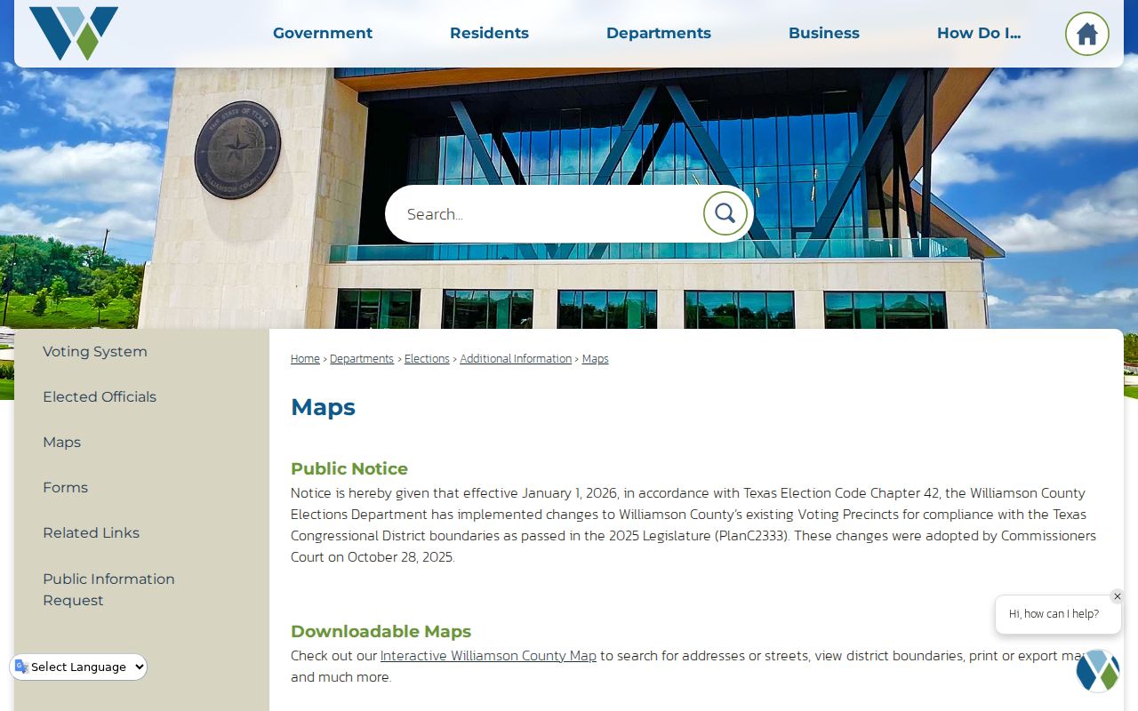
The county’s interactive maps page can search an address, street, or district and supports print or export functions. It notes precinct changes effective January 1, 2026 under 2025 PlanC2333. Check the live map before relying on a prior precinct number or district assignment.
A precinct match shows geographic context, not that a particular person resides at the address. The state voter route itself is controlled: documented My Voter Portal paths use Name plus County plus date of birth, VUID plus date of birth, or Texas driver license or ID plus date of birth. Voter protections and address confidentiality still apply, and a web opt-out removes display from the county and SOS lookup pages without creating a universal deletion from every records process.
The official Williamson County maps page is pictured below. It is useful for checking a block’s current election geography after the parcel work is complete.
Use the map to describe the place, then return to the parcel account or a lawful voter process for any separate record question. It does not turn a precinct into a neighbor list.
Association Context for Brushy Creek Neighbors
Brushy Creek MUD’s neighborhood page is a geographic guide for Cat Hollow, Meadows of Brushy Creek, Sendero Springs, Brushy Creek Village, Woods of Brushy Creek, Highland Horizon, Hunter Brook, and other named areas. It is a public district, not an incorporated city, and it says it partners with HOAs without managing them. Treat a neighborhood name as a way to select the right map, plat, or association contact, never as membership proof.
| Community context | Useful block question | What it cannot establish |
|---|---|---|
| BCMUD neighborhood grouping | Which local name or service-area context to check | Current household membership or occupancy |
| Plat, restriction, or legal subdivision | Lot, block, common area, and street development context | A current resident roster |
| Association board or management contact | Where lawful association information may be directed | Private directory access or member identities |
| Texas management certificate search | Association infrastructure and contact lead | Complete or independently verified association data |
The Texas management-certificate search permits searches by association details and geographic filters, but the state warns that its information is user-contributed and may be incomplete. Confirm any association information with the association or governing documents, and do not ask an association to disclose a private membership list.
Permits Add Context, Not Brushy Creek Neighbors
For unincorporated development, Williamson County uses the MGO route for permits and planning processes. A permit application can connect a project to a physical location, but an applicant, contractor, or contact is not automatically a nearby resident. Exact public result fields and historical coverage were not located in the official research, so avoid treating a portal result as a resident directory.
The official Williamson County MGO portal appears below. Its address-oriented workflow can help distinguish a parcel or project question from a search for people.

A permit source may clarify development timing or which government has jurisdiction. It should remain a property and project record, not evidence that a named person occupies a surrounding home.
Official and Commercial Categories for Brushy Creek Neighbors
| Category | Best use | Limit to keep visible |
|---|---|---|
| Official parcel, GIS, and clerk records | Trace a specific parcel, legal description, or recorded interest | Each source has a defined purpose and may show owner rather than occupant |
| Official election and district sources | Confirm current geographic context under statutory rules | Protected data, web-display choices, and use limits remain in force |
| Library directories and newspapers | Find a dated historical address or community reference | Coverage is incomplete and a listing is time-bound |
| Commercial neighbor-search tools | At most, generate a lead to verify independently | Data can be stale, mixed between people, incomplete, or detached from the original custodian |
Use the original custodian whenever an answer matters. A dated WCAD parcel record plus a recorded instrument has a clear provenance; a generic profile category does not. Avoid merging records just because names share a street, neighborhood label, or ZIP.
History Can Date a Brushy Creek Block
Subdivision eras can explain why a street is absent from an earlier source. The county profile places Spanish Oak Terrace and Great Oaks in 1973 to 1975, Tonkawa Springs in 1977, Woods in 1985, Fern Bluff in 1986 to 1987, Cat Hollow in 1987, and Stone Canyon in 1995 to 1996. A current lot can also sit in a land chain that predates street numbers, so older work shifts from address keys to grantor, grantee, survey, tract, plat, and legal-description terms.
That change in search key has a local story behind it. Brushy Creek includes eight headright tracts, and the county’s historic land narrative follows the Dillard, Hail, and Dugan chains through land claims, probate, and later transfers. It is a reason to read an older block through legal descriptions and party names rather than force a modern subdivision street into an early index.
For a dated historical layer, the verified Cole directory collection spans 1993, 1994, 1996, 1997, and 2001 through 2020, with gaps. Round Rock Leader microfilm covers 1929 through 2021 but has incomplete periods. A directory or news entry should be labeled as “listed at address” for its year, not projected into current occupancy or used to infer a relationship among Brushy Creek neighbors.
Privacy Boundaries for Brushy Creek Neighbors
Texas does not make every address-related record an open people list. Courts use judicial-record procedures rather than ordinary public-information requests; vital records have confidentiality and eligibility rules; voter records have Election Code protections; and motor-vehicle data has separate federal limits. Ask a custodian for a specific existing record and expect redaction of protected portions. Do not republish Social Security numbers, financial-account numbers, complete ID numbers, or protected addresses found in recorded documents.
The Address Confidentiality Program can provide an eligible survivor with a substitute mailing address. A protected or substitute address is a safety feature, not a missing-neighbor clue. Texas anti-stalking and anti-harassment laws also set a clear boundary: a nearby parcel, precinct, or association name cannot be used to monitor, threaten, repeatedly contact, intimidate, or expose someone.
Lawful personal use. Use a Brushy Creek neighbors search for careful community context, family history, estate research, civic information, or personal safety awareness. Do not use information from a block search to stalk, harass, intimidate, or harm another person.